Day 70: July 25, 2023 Imp Campsite Shelter to US Route 2 Elevation+1674’/-3905’ 9.2 Miles/839.4; 1899.9

What a stormy night I had. The rain came back, surprise, surprise and with it, was gusty winds. The blessing was that after the rain stopped, the wind virtually dried the tent. It was a bit damp but nothing unreasonable. All of us gals were up and out by 6:30am.

Stony Brook – Water Supply Today

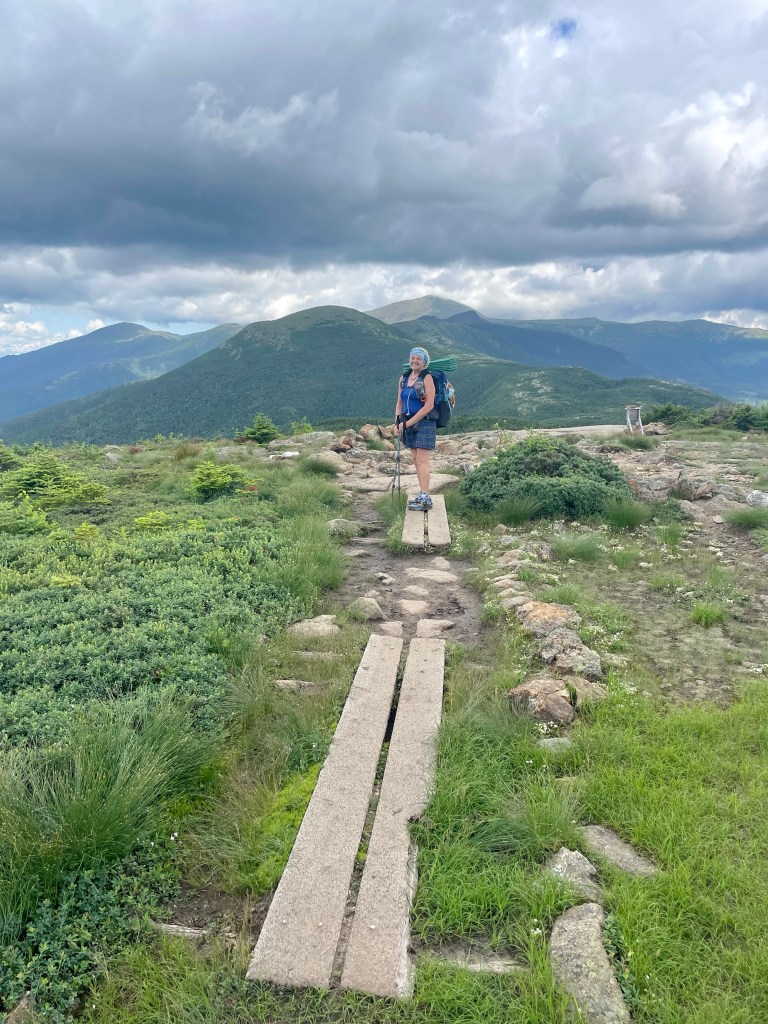
We had one final climb, Mt. Moriah. It was up and down for the first mile or so, and then started the climb. There were great views along the way and many false summits. Luckily most of the rocks were dry after our storm last night. That is always my concern. You just don’t get very good traction on wet slippery rocks!

Trail Leasing to Mt. Moriah

The rocky summit of Mount Moriah, is about 50 yards from the Appalachian Trail at its junction with the Kenduskeag Trail. This is the last of the major peaks of the White Mountains for northbound AT hikers. There are fine views all around, from the Mahoosuc Range as far as Old Speck, to the White Mountain peaks including Mount Washington. There are views of the Carter Range, and of the mountains on the east side of the Wild River Wilderness, like Royce and Baldface. There is also a view down into the town of Gorham and the Androscoggin River valley. We had seen all the views we needed and chose to continue the long descent downhill.

Overlooking White Mountains & Valley

The route was truly down, close to 4000’. It mostly was covered by trees with very little views. We tried to find a place to stop and eat, but the area was fairly boggy and no real options. We finally settled on a mossy log that I draped my green mat on top of. That was as good as it gets today. We ate and continued onward.

Wild River Wilderness

We talked with a couple of Sobo’s who had different assessments of the trail ahead. One guy told us it was lovely, with fine river crossings and he only had 2-3 days of rain in all of Maine. Unless he was on a jet plane, or in a different part of Maine, that was a fantasy. Another told the story of trail much like what we have been doing. The Whites are still a nuisance, and climbing continues for the next 50 plus miles. Don’t expect to get high milage as you inch your way northbound. Swell. At least a realistic picture of what’s to come.

Mushrooms Everywhere in Da Forest

We stopped at Rattle River Shelter. It’s a very old dilapidated shelter in disrepair and grateful we would not be staying for any amount of time. There was a large group of 7-10 year olds that were in a Summer Camp, with plastic magnifying glasses and a sense of adventure. Many of them were quite inquisitive about why we were living out in the woods. Mary Poppins and I had quite the discussion about our state of homelessness. It feels like we are a bit displaced, wandering from shelter to tent site to hostel to hotel. Never really knowing where we will lay our heads down. Fortunately for us, we do have lovely homes to go back to. But for now, we wander northbound.

Rattle River Shelter

After our second lunch on the trail, we finished our last two miles. It was easy going. Actually a dirt trail with little obstructions in our way. The Rattle River crossed the trail a few times and we skipped over river rocks to get to the other side. There were quite a few locals that were using the trail, walking their dogs, and appearing to consider swimming in the frigid waters. All I could think of was getting to the road and meeting Rob, our Personal Taxi Driver. Blue had arranged for a pick up at 2pm but we were an hour early. Lucky for us, Rob was in town and arrived fairly quickly. Mary Poppins found a Blueberry Bush and we all indulged in a few berries before Rob arrived.

Perfectly Graded Trail

Back to Quality Inn for the evening. We arrived too early so the room wasn’t quite ready. No problem as we are hungry hippos and walked to Mr. Pizza and ate our third lunch for the day. Afterwards, Blue and I went to the Post Office and then headed back to our kroom.

Town of Gorham, NH Population 2698

Our next days will be a 50 mile stint with much of the same. Lots of climbing and heading over the Mahoosac Arm or Notch, as they call it in these parts. This will conclude The Whites. Hopefully our weather will cooperate and we will have clear skies and cool days ahead. That’s my most perfect plan, but we know how that goes. For now, we are packing our food bags, Blue is doing laundry and I’m mailing postcards. Such the life of a temporarily homeless person.

Dad, Me & Sister Kari

As I write this today, my sister Kari called me about the health of our Dad. He has heart problems and was retaining fluid. His Doc gave him a little extra medicine and that caused more issues. Dad, I am thinking and praying for you, and my friends on the trail are doing the same. Get strong and keep loving the Lord. You are my inspiration to keep moving forward, taking one step after another to finish this journey. I love you so much and pray you continue to get healthier and stronger. Much love from your wandering daughter.

Day 69: July 24, 2023 Carter Notch Hut to Imp Campsite Elevation+2717’/-2609’ 8.0 Miles/830.2; 1891.7

Last nights Bongo Drums must have lulled me to sleep because I was out. At the Huts they all have a special way to wake up the guests. Brian has a xylophone and was singing a song of praise as he hiked to the different dorms. It was much better than any other wake-up song I’ve heard. Breakfast is served promptly at 7am. We had juice and coffee, with oats, pancakes, bacon and eggs. What a great meal to charge us up the many peaks today.

Sunrise at Carter Notch Hut

We left late, around 8:30am but have a short day, as it looks on paper. We had Carter Dome as our first climb. It was 1800’ of climbing mostly granite stairs with light bouldering. We took our time and made it to an unremarkable dome that was mostly tree covered.

Carter Notch Pond

The highest peak of the Carter Range, Carter Dome 4821’ was once the site of a fire tower, but is now mostly wooded. A partial clearing on the north side of the peak provides a nicely framed view north along the Carter-Moriah Range, and further into Maine along the Mahoosuc Range. This was the first time we could truly see Maine. We checked out the footings of the old fire tower and meandered down.

Carter Dome

Our second and much more significant peak was the rocky summit of Mount Hight 4665’, an arm of Carter Dome. It provides 360 degree views of the eastern White Mountains, with phenomenal views east into the Wild River Wilderness, including Baldface Mountain and Mt Royce. To the north and south, there are fine views of the entire Carter-Moriah Range, and some of the Mahoosucs. To the west is a stunning view of the Presidential Range. This was our lunch stop. It was spectacular with panorama views in all directions. There were many others taking in the beauty on top of Mount Hight.

The Presidential’s in the Background

We met Toothbrush the Moose who Norman was quite excited to see. He belongs to a 3 year old that allowed her Dad to take him out to climb all the 4000’ peaks in New Hampshire. Toothbrush and Norman had many stories to share of terrifying climbs, ascents and descents on sheer cliffs along with wicked river crossings and weather phenomenons that they just don’t truly understand. I think some of it was hyped up a bit but they are still recovering from all this stimulation. Norman was living in a Bingo Hall only two months ago with a bunch of Blue Hairs and Toothbrush, he was in a little girls room that has tea parties and plays with dolls. This could be quite frightening for anyone who lived, such a sheltered life!

Toothbrush the Moose Climbing 4000’ Peaks

After lunch, we nodded farewell to our new friend Toothbrush and carried on. We had three more peaks to conquer, South Carter 4411’, Middle Carter 4595’ and North Carter 4515’. As we reached the rocky crag near the summit of North Carter Mountain, it’s interesting that neither Middle or North Carter are considered 4000’ peaks to peakbaggers due to their lack of prominence. It doesn’t matter that they are well over 4000’ but they don’t have what it takes to be a true 4000’. It has something to do with the actual climb from the base to the top and being the three peaks are connected, the South Carter is the only one that is listed in the official 4000’ Peakbaggers’ digest. I learn something new, almost everyday.

Blue with Cassian on North Carter

Once we finished our climbing, it was a super steep downhill course of, you guessed it, boulders and granite. I really should’ve brought a rope because rappelling would be a worthy challenge out here. And useful as all get out! Cassian aka Cash Money, was traveling with us on the downhill. It was a bit sketchy and you should always be with someone while you’re doing this type of sport. We all pitched in, taking turns, picking lines and figuring out the best route to take. It was challenging to say the least, but also it was a bit of fun too. After two hours, we descended our 1.9 mile course and arrived at Camp Imp.

Final Path into Camp Imp

Imp seems like an odd name for the final campground in the AMC district. As we arrived, I told Mary Poppins to go ahead and set up her tent. The sky was ready to pour down liquid sunshine! And sure as I predicted, I arrived and it started raining. You get to know the weather around here and it’s fairly obvious. Cloudy, thunderheads and wind blowing. I set up my tent next to Mary Poppins on a platform. It’s as good as it gets. Not perfect but solid and once inside, I’m dry as a bone. I needed to get water so loaded up my containers as well as Mary Poppins and filled from the cascading river. I was soaked by the time I got back and hunkered back in my tent. I made my nest, and started dinner.

Our Tents Pitched on Platforms

After eating, the rain stopped and Mary Poppins told me the view from the Shelter was superb. So in my PJ’s I headed over and watched the most beautiful sunset on the trail. All from the comfort of an Adirondack chair that someone constructed from local wood in the forest. Cassian was already sitting on a chair and we talked of our faith. He is a Priest and also blogs about his encounters with God. Seekinggod.Substack.com We sat and watched the sunset with Mary Poppins. It was the perfect ending to our perfect day, on the trail.

Sunset from Imp

As I look back on these past days, I can only thank the Lord for placing these incredible people around me. Blue and Mary Poppins have been the center of it all, and daily the Lord brings others to enhance my experiences out here. Last night Cassian showed up at Carter Notch Hut. He sat with us at dinner and breakfast and we kept running into him on the trail. He is a quiet man with a soul that chases after you Jesus. As I was heading to the Shelter, he was on the side of the trail taking communion. What a beautiful testimony of a man after your own heart. I am in awe of the people you have witnessing to me while I walk in the woods. Thank you Lord for always reminding me of your faithful servants, even when I am miles away from church. This truly is my church right here, right now, on the Appalachian Trail. Amen.

Seekinggod.Substack.com

Day 67-68: July 22-23 Zero at Pinkham Notch to Carter Notch Hut Elevation+3029’/-1703’ 5.9 Miles/822.2; 1884.7

After our past week in the Whites, Blue and I were ready for a Zero. This is the only way we will make it to Maine. We took the day off in Gorham, New Hampshire. It’s a small town with all the conveniences that a hiker needs. Dollar General, Restaurants nearby, laundry and our first, indoor pool and jacuzzi. We took advantage of all of the above. It was a well needed day of rest.

Jacuzzi & Pool Day

Our neighbors were up late last night. They are from the Netherlands and building a massive Greenhouse. It’s eight acres in size, three stories tall and made from steel and glass. They hired a few laborers from California and plan to be in NH for 8-10 weeks. The crew are all staying in the same hotel as Blue and I, The Rodeway Inn. After talking till hiker midnight which equates to 9pm, I went to bed. The guys were up till 2am, laughing and talking until the wee hours of the morning. At 6:15 Blue woke up and woke me. Oh my gosh, our ride will be here in 45 minutes. Luckily we were already packed. I just needed to grab something to eat, Blue made her coffee and Rob whisked us away to the trailhead promptly at 7am.

Neighborhood Moose & Fusge

Mary Poppins was waiting for us and we all hit the Wild Cats at 7:30am. This section of the AT is deemed the steepest of the entire Appalachian. Oh boy, here we go. It’s a short mile day but we will be lucky to move at one mile per hour. It started like most days, a bit of off-trail roundabouts, going over large boulders and through water crossings. And then the fun began. The rock climbing was a bit more aggressive today. It was a definite no poles kind of climb. You needed your hands to be free to move up the rock face. Quite exposed and a bit unnerving.

Lost Pond with Mt. Washington

As we continued up the 3000’ climb which was only two miles long, I was quickly reminded of how fast things can go wrong. All three of us were attached to the rocks like Spider-Man and there was no mistakes made. We did exactly what we needed to do and that was climb!

Bouldering with Packs

Before noon, we arrived at the top of Wildcat Ski Area’s gondola station. There was a clearing with several picnic tables and clear views to the Presidential Range. There is also a cleared view to the south, looking toward the Doublehead Mountains, Mount Kearsarge, and others in the North Conway area. On a crystal clear day, you can see the Atlantic Ocean. It was clear with just enough haze that the ocean was not visible, but we could see quite a few of the mountain ranges. The only issue was, why did we just climb this crazy rocks when we could’ve taken the gondola? That’s the hundred dollar question. We sat and had lunch, talked about the remainder of our day and resumed our rock climbing.

Wild Cat Gondola

The fourth summit of Wildcat Mountain is fully wooded, but is marked by a large wooden observation platform. It had nice views that we took in for a moment or two and carried on to the next summit of Wildcat Mountain. It also is a wooded peak at the east end of the Wildcat Ridge. A short spur trail from the peak leads to a cliff with stunning views to the east. Directly below, about 1200 feet down, is Carter Notch with two ponds and the Carter Notch AMC huts, which we have reservations.

Carter Notch & Ponds

We stopped and took in the view from the ledge and marveled over the fact that number 1, we are hiking down to the bottom of this, and number 2, we will be hiking straight back up tomorrow. It will be a lot of steep climbing and descending in these White Mountains. We met up with another thru-hiker who planned to stop at the hut for his customary bowl of soup and bread. Then planned to hike out and over to IMP Campsite. That’s a lot more hiking, and we are saving that for tomorrow. Hence the difference between youth and not-so-youth. We are three times his age so we’ll just do what we do. Be ever so kind to our bodies!

Ledge Overlook

We descended the boulder steps and rock slides, which are best negotiated on your butt. No point of walking down them as they are pretty much vertical and you are going to land on your butt one way or another. We slid down!

Rock Slide

Close to 3:30, some eight hours after we started, we arrived at Carter Notch Hut. This Hut is the easternmost of the AMC White Mountain Huts, is one of the smallest and most remote. It is located in the deep notch between the Wildcat and Carter Ranges, next to a pair of mountain ponds and accommodates up to 40 guests. It is the oldest hut that is still in commission and was built in 1914. This is the first hut we actually made reservations at ahead of time. And I’m so glad we did.

Carter Notch Hut Circa 1914

We checked in and got our bunkhouse which has six beds that the three of us are the only occupants for the night. Such a deal. We offloaded our gear, changed and received our gratis bowl of soup, Tomato Bisque with homemade bread. We ate that and proceeded to finish all our daily snacks and bars. Blue and I are consuming quantities of food that we would never attempt at home. And still hungry! It’s unreal.

Our Private Bunkhouse

We unpacked, got our beds made the way we like and headed for dinner at 6pm. The Croo made Lentil Soup, Poppyseed Rolls, Salad, Stuffed Cheesy Shells and Peas. It was good eats and the huge chocolate buttered chip cookies with coffee topped it off. After dinner, we headed to our bunks and hit the sack. Until our neighbors started playing Bongos. You’ve got to be kidding me??? Not tonight. I need to sleep.

Our Bunkhouse with Carter Notch Behind

Day 66: July 21, 2023 Lake of the Clouds to Pinkham Notch Elevation+3699’/-6197’ 14.9 Miles/816.3; 1878.8

Work-for-Stay has one caveat that didn’t work so good for me. The sleeping arrangements are in the Dining Hall. Typically, lights are out at 9pm, and the hikers bed down. The Croo that was on staff at Lake of the Clouds are young and very open to interpretation. Lights out at 9pm but if you want to play cards or games or talk, use your headlamps. Finally at 10pm I was attempting to get some sleep. That is way past hiker midnight.

Sunrise Over Mount Washington

At 5:30am, I was up and packing. Little sleep and much hiking to do today. The weather was socked in, fog, mist and a severe wind advisory! 30-40 mph with 50mph gusts. The coffee was slow to come out of the kitchen and there were many hikers pacing looking for caffeine, including my Blue. She requires coffee in the morning. Around 7am we headed out the door and didn’t look back.

Leaving Lake of the Clouds – Our Trail

The climb to Mt. Washington was tough. It was nothing but rocks and boulders. No dirt to speak of and the visibility was 10-20 feet. Nothing like yesterday. We finally arrived at the top to find nothing was open. The Snack Shop and Sovereign Store opens at 9am with coffee, tea and hot cocoa. Nothing for Blue and I. We needed to put more layers of clothes on as it was crazy cold and windy. I opened my pack, grabbed my second rain jacket as I was stepping on my folded mat. Well I must not have secured it because with a gust of wind, my mat went flying! There was no stopping it and it was long gone. Dang it. I really liked that green mat.

White Rock Cairn Guides Hikers

I got dressed and Blue put on more layers and we headed towards the trail. To my surprise, my green mat was folded up and perfectly positioned in front of the side door to the abandoned building near the trail. There is no way on God’s green earth that my mat should be anywhere but Kansas! But somehow, someway, it was waiting for me. That’s nothing short of a miracle. I think my Lord is up to something. Maybe a warning to buckle up and get ready for what’s ahead.

Happy For My Green Mat

Our morning was nothing but a Rock-Boulder scramble that went on for seven miles! It was absolutely the worst of the worst when it came to hiking the AT. It was one Boulder field after another. I’ve never ever had to hike for seven miles on boulders until today. My feet are so sore. I was intensely focused on each foot placement that I could hardly look at anything else. The weather was wet and cold, windy with crosswinds that tried to blow me off course. It was difficult to think about anything else but breathing. I finally had Blue stop so I could eat something. We sat on a rock field as that was our only choice and ate quickly. The seven miles took us seven hours and we finally arrived at Madison Spring Hut.

Another Beautiful Day in Paradise

Located in the col between Mounts Madison and Adams, the Madison Spring Hut is a very popular destination for hikers of all sorts, and a good place to base hikes to the northern Presidential Range. This hut has bunk space for 52. Blue, Mary Poppins and I stopped for our gratis bowl of soup. I was ready to spend the night and so was Mary Poppins. They had quite a few cancellations due to the weather. It was miserable outside with at the least a four-mile descent to get to the nearest exit strategy.

Madison Spring Hut With Mary Poppins & Others

Blue was quite adamant that she wanted off the mountain and in town. She was ready for a shower and laundry and had no plans to stay in a hut. Mary Poppins was adamant that she was staying at the hut as she was sick and tired, and had fallen three times. I, reluctantly, left with Blue and hiked the additional four miles downhill. Lucky for us, the rain stopped and by the time I was halfway down the mountain, I shedded my rain jacket and windbreaker. Around 5pm, ten hours since we stepped foot on the trail, we arrived on solid ground. Blue found us a ride and a hotel room in town.

Leaving Mount Adams

The driver took us to The Barn Hostel where we both had packages waiting for us. There was no room for us at the Hostel, which is fine with me, so we paid the owner $15 to get our packages and went on our way. My past hiking partner, Couch to Trail was staying at The Barn. She has a little over 300 miles to hike and is beat up, tired, injured and plain ole exhausted. After hiking since February, she’s decided today to go home.

Couch to Trail Heading Home

Mary Poppins is feeling like she too is at her end point. When I was talking with our driver, he said this is really typical of hikers after The Whites. It just beats em’ up, wears them down and spits them out!

Our Mary Poppins

This past week or more has been some of the toughest miles on the AT. Between the elevation gains and losses, the extreme weather, the mud and muck, the rock climbing, the Boulder Fields, and everything in between, I can understand why hikers are feeling defeated. This is tough terrain, in an environment that is ever changing. I talked with a Sobo yesterday and he told me he could tell all the Nobo’s that he met by the look on their faces. He said they are tired and many are discouraged. He just started a few weeks ago in Maine, and is excited about the next four to five months. It made him wonder what he’ll be like when he’s nearing the end of his hike?

Cog-Wheel Train Tracks To Mount Washington

So much of hiking is facing the everyday adversities that come your way. How do you respond makes the difference as to whether you continue or not. And another huge part is having a good partner. Blue and I are good partners. We may have different needs and desires, but at the end of the day, we can always find common ground. It is much like a marriage and the fact is you don’t always get your way. Today I would of rather stayed at Madison Spring Hut but Blue wanted something different. I understand that and it’s what makes us more tolerant, accepting and teaches me how to be a better person, great partner and best friend. I think that’s exactly what Jesus would desire of me. And maybe to finish this trail for my friends that will not?

Best Hiking Partner Ever

Day 65: July 20, 2023 AMC Highland Center to Lake of the Clouds Elevation+5073’/-1347’ 9.3 Miles/801.4; 1863.9

And we are off again. After a wonderful breakfast at the AMC Highland Center, we headed up Crawford Path.

Leaving AMC Highland Center

In 1819 Abel Crawford and his son, Ethan Allen, cleared this path to treeline near the top of Mt. Clinton. Along this trail the Crawfords guided many groups to the summit of Mt. Washington. The trail was improved to a bridle path in 1840 with Abel, then 75 years old, making the first ascent of Mt.Washington by horseback. By 1870 this historic path reverted to its original use as a footpath to the heights. The Crawford Path is a connector that brings us back to the Appalachian Trail, and was a perfect choice for Blue and I.

The Crawford Path

The Presidential Range of the White Mountains is the highest range of mountains in the northeast and is home to the largest above-treeline alpine zone. As well as being a popular recreation destination for tens of thousands of people every month, it is also home to some of the world’s “worst weather”. Freezing temperatures and hurricane-force wind are not uncommon even in the middle of the summer. But today is a picture perfect day with visibility over 100 miles.

The Presidential Range

As Blue and I were hiking to Mizpah Spring Hut, we ran into no less than 30 girls who belonged to a Summit Club, out of Maine. Each year they climb a peak and spend a few nights in the wilderness. This year it was Mt. Washington. The girls ranged from 10-12 years old and had two leaders with them, one guy and one gal. Kudos to the guys as there was a lot of estrogen flowing! I gave them all high fives as I passed. What an accomplishment for these ladies.

Summit Club of Maine

Mizpah Spring Hut is the second largest AMC Hut in the White Mountains, located at the south end of the Presidential Traverse. The hut is a full-service mountain lodge with bunk space for 60. Blue and I made it in time for pastries. There was Pumpkin Bread with Chockate Chips and Blueberry Coconut Cake. Yum, we had one of each. The coffee was hot and the goodies were tasty. Being we are now members of the AMC Huts and thru-hikers, we are entitled to two free pastries and a cup of soup. Such a deal for a whopping $10.

Mizpah Spring Hut

Once we left the hut, we headed up to Mount Pierce. It is one of the southernmost peaks of the Presidential Range. As I reached the summit, I was smiling from ear to ear. There were three Canadian Hikers on top, Stephanie and Sue (twin sisters) and their friend Janice. We had a great laugh over my endless smile, which seemed to lighten up their day. I was so dang thrilled that the sun was shining and the skies were clear. The views from the summit are some of the most spectacular of the Presidential Range. From atop Mount Pierce, we could see across Mount Eisenhower and Monroe to Washington, and beyond to Jefferson. This is why I hike mountains. It just takes my breath away and brings me to tears. What an incredibly creative God we have!

Blue, Janice, Sue, Stephanie & Me

As Blue and I continued north, it just got better and better. It was hard to hike as all I could do was gaze over the vastness of this mountain range. I have talked with many hikers who powered through the Whites in blustery conditions, in rain and wind, with less than ten feet of visibility. Yet here Blue and I are on this trail with endless vistas and mind blowing views. I know that many of you have been praying for our safe passage through the Whites, and for a window of weather that would allow us to enjoy this beautiful mountain range. Your prayers have been heard and we were blessed beyond measure!

Beauty Beyond Measure

Mary Poppins caught up with us near our final uphill at Mount Monroe. What a Mountain Goat she is. I told her to go ahead so she could get her Work-for-Stay as Blue and I had no intentions of doing that. She took off like she had a fire lit behind her. Gosh that gal can hike fast.

Mount Washington & Beyond

When we arrived at Lake of the Clouds Hut, Blue and I had planned on sleeping in the Dungeon or paying for a room. Trish told us there were many options including Work-for-Stay. I asked her what that entailed? There is a compost pile that needs some tending to. Hmm, that sounds like a perfect job for Blue and I. Blue is like, uh, I think I’ll look in the dungeon and sleep there for $10. I say, well we can do that and still help with the compost pile. And so we checked the dungeon and decided Work-for-Stay wasn’t such a bad option. Honestly, with all that we have received from this trail, the least we can do is a little work.

Turning Food Straps Into Compost

Blue and I get all decked out like Haz-Mat workers. We walk down the hill to a caged area, open up the chain link fence and take in the odor of stale rotten food turned compost. Flies are buzzing and I dive in. Pitch Fork in hand, I start turning compost and so does Blue. The big difference is that I have a Buff around my nose and mouth which helps with odor control. Blue piles in the shavings and I rotate. It’s quite the job as this compost pile has been marinating for some two months. I probably need to say no more! After thirty minutes of rotating compost, I think we have completed our task. Job well done girls. I told Blue I think this is God’s way of keeping us humble. It worked.

Humble Servants

The rest of the afternoon was spent relaxing and doing a little bit of yoga. The sunshine never stopped and the views were indescribable, even for a blogger. Around 7:30pm, Blue and I came into the Dining Room and helped clean tables while Chowder and Hot Cakes swept the floor. Best floor sweeping I’ve ever seen as that will be where we sleep tonight. Thanks Team.

Mary Poppins, Blue & I with Mt Washington in Background

Such a great day and overwhelming blessings. Oh, and one more thing. Mary Poppins and Cookie Monster arrived first at the hut. Some sweet person donated two beds to the first thru-hikers that showed up. There could not have been a more deserving person to revive this gift than our most precious Mary Poppins. That’s the way our God works! The only thing left to share is the most marvelous sunset I have witnessed while on trail. Absolute perfection.

Chowder & Hot Cakes During Sunset

Day 64: July 19, 2023 Zealand Falls Hut to AMC Highland Center Elevation+680’/-2009’ 9.5 Miles/792.1; 1854.6

My body clock is set to 5:30am. There were no birds chirping in the hut, no one making any noise, just that circadian rhythm that tells me it’s time to get out of bed. It’s lovely. I was so refreshed and excited about this day.

Sunrise-Sunset over The Whites

At 6:30am, the Croo as they call themselves, sang a wake-up song. It was pleasant and slowly all the guests were up and heading to the Dining Hall. Breakfast is served promptly at 7:00am. Everyone is seated and the table is set. My Mom would be so delighted. She loved a proper table setting! We had juice, peaches, oatmeal with all the toppings, pancakes and bacon. And of course coffee and tea. Everyone was jovial, talking about their days hike, either home, onward to the next hut or as in Blue and my case, down the trail. The interesting fact is the only way to access these remote huts is by foot. No bikes, trains, horses or mules, just your own two feet. It’s quite proper, I must say.

Leaving the Hut – Beautiful Morning

After breakfast, Blue and I packed up and headed to parts north. It was an easy day, mostly downhill with less than ten miles. But easy ten miles. No crazy climbs, or boulders to negotiate, just a simple foot path. After the downpour we had last night, I expected a bit more muck, but nope, little muck and more dirt.

Interesting Pink Fungi or Mushroom

The trail out of Zealand Falls was perfection. It followed along a narrow path of gravel and looked over a giant rockslide on the side of Whitewall Mountain. There were wonderful views up Whitewall Brook Valley and up to Zeacliff. It reminded me of the Tahoe Rim Trail on the East Side of Lake Tahoe with the loose gravel and huge boulders. It was such a pristine area with cascading waterfalls and the Pemigewasset River below.

Whitewall Mountain Slide

When we crossed over the river on the wooden bridge, I noticed a tree growing some type of red berries. Of course I had to try them and they were delicious. Blue said they had something similar in Russia. I have no idea the name of the tree but it sure was tasty! We found a few more berry producing trees as we walked near the river. They filled us up for sometime.

Unknown Red Berry Tree

The morning was delightful, with easy walking and mindless miles. Before I knew it, we arrived at Ethan Pond. The water flows from the North Fork of the East Branch of the Pemigewasset River. The water was brackish color like much of the ponds we see but the views up the lake were stunning. We found a rock and sat on it as we ate our second breakfast-lunch. Yes, we do eat a lot.

Ethan Pond

With only three miles to go and mostly downhill, Blue and I were cruising. We found a Blue Trail that would take us directly to Willey House Historical Site. That sounded like a good option and was going the same direction as the AT. So being the explorers we are, and Blue getting bored by the mundane trail, we took the Willey Route. It woke me up quick. It was steep with a lot of root negotiation and loose rock underfoot. You never know what you’re gonna get when you take a unmarked trail. It may have been .5 miles shorter, but it took some careful stepping and a few death defying leaps of faith. We crossed over the railroad tracks and before long, we arrived in civilization.

The Willey House & White Mountains

The Willey House is more of a Souvenir Shop with Ice Cream, Sodas and Coffee. Sounds good to me. I started talking with a gal Margaret from Tennessee. She was on a road trip and touring New England. She has a cool converted van that she drives from place to place, stops and parks whenever she finds something worthwhile. After talking about hiking and her sharing her travels, we asked Margaret for a ride. She was happy to give us a ride and took us to the AMC Highland Center just up the road. Margaret had Bible Scriptures in her van and I knew that this was exactly where we were suppose to be. She showed us the beautiful waterfalls along the way and drove us to the front door of the Highland Center. What a wonderful encounter with a fellow Christian. Thank you Margaret and may the good Lord continue to bless you along your road-trip, and thereafter. Hope to meet again. Maybe on the trail.

Our Trail Angel Margaret

Yes, Blue and I are relaxing off trail before we finish up The Whites in the next couple of days. These last three days on trail have been difficult with the constant elevation and death defying climbs. I think both physically and mentally I have been drained. Today was an exception. We had great weather, an easy trail and honestly, I think we both needed that. Tonight we have a private bunk room with all our gear hanging up and drying. We took showers and washed our socks and underwear in the sink, as there is no laundry for 30 miles. But we made due with what we have and it was fine.

The AMC Highland Center

Our perfect and wonderful Lord has given us a great opportunity to rest and prepare for the upcoming climb. Thursday we will head back up the trail and take on the Presidential Peaks, Mt. Washington, Mt. Pierce, Mt. Monroe and many others. We have a good window of weather today and Friday, well come what may. No point of fretting over tomorrow as today has enough worries of it’s own. Right now, we are well fed, warm and dry. Norman and Bob the Bear are relaxing and ready to take on whatever we are willing to dish out to them. What good companions we have. Oh, and Blue is not so bad either 🤣 . What a great friend and perfect hiking buddy, Blue is indeed!

Me and My Blue

Day 63: July 18, 2023 Garfield Ridge CS to Zealand Falls Hut Elevation+2493’/-4092’ 9.8 Miles/782.6; 1845.1

Garfield Ridge CS was anything but restful. Oh my goodness. There were two people with hammocks that showed up around 8pm. Ends up the young man has vivid dreams. He was up several times screaming about his guide lines were not secured, then he was trying to get out of his hammock at 2am, looking for who knows what. The Canadians arrived late also and were trying to be quiet but it’s hard when you’re pitching your tent, getting your gear unloaded and cooking. My bedtime was severely delayed, and I am pooped this morning.

Mt. Garfield Ledge

Blue was up early and ready to leave at 6am. She is getting to be an early riser. I was out at 6:30 and she was waiting for me at our very steep downhill, which turned into a cascading waterfall. My feet were wet from the moment I stepped on the trail, ugh. The downhill was 800’ of boulder stepping and hanging onto roots and trees. Good morning knees and quads!

Zealand Falls

Blue and I stopped at Galehead Hut. It is located at the base of South Twin Mountain, high above the Pemigewasset Wilderness. The hut is one of the more remote AMC Huts, and it is close to many of the most spectacular 4000-foot peaks of the Whites. We stopped in looking for tea or coffee, and any breakfast leftovers. We scored tea but no food. So we ate our beef sticks, cheese and Blue had her big delicious apple. And we drank our lukewarm tea. Beggars can’t be choosers.

Galehead Hut

Today’s weather reported afternoon thundershowers with lightning. As long as it holds out till late afternoon, we will be fine. After a steep climb from Galehead Hut, we reached the open, rocky summit of South Twin Mountain. This is the highest peak in the Twins and Bonds area, and usually has fine views. Today it was hazy and smoky with cloud cover. The views weren’t too spectacular.

South Twin Peak in the Clouds

The trail meandered down and then leveled out for most of the morning. It was some of the flattest path I’ve had in quite sometime. Blue and I had a Little Rock scramble near Mount Guyot and found a patch of dirt to have lunch on. It was a great view of the surrounding mountains. The area was Alpine with miniature trees and rock flowers. The only thing missing is the area is void of any critters. A bird or two but nothing else.

Mount Guyot in Background

Once we headed back out, the thunder rolled in and so did the rain. It was coming down in buckets that I used both my umbrella and rain jacket. This time the rain was much cooler which is par for the course being we have entered the White Mountains. It rained for a couple of hours. This is getting a bit annoying and makes me question how much more I can handle? As soon as I started having thoughts of Hawaii, and laying on a beach somewhere, the rain stopped and the sun attempted to shine.

Pemigewasset Valley Boardwalk

Blue and I decided we should stop at Zealand Falls Hut and see if they have soup or hot drinks. We headed down our final descent and met one of the Caretakers of the Hut. I asked if they had a full house and she said they just had a couple of cancellations. You’ve got to be kidding? She said we should checkin and stay for the night. I definitely was not doing a work-for-stay because I’ve already worked all day hiking. But I’m willing to pay for a bunk and get dinner and breakfast, plus stay out of the rain for the night. What lucky ducks we are! Seldom do these places ever have availability. Talking with most the guests, they reserved months ago. I paid, found my bunk and headed to the waterfall to cleanup.

Triple Bunks – I Scored Tippy Top Bunk

This Zealand Falls Hut is one of the nicest of the AMC White Mountain Huts. It’s located next to a grand waterfall with views of the Willey Range and Whitewall Mountain. Because of its accessability, the hut draws some of the largest crowds in the Whites and accommodates 36.

Zealand Falls Hut

Dinner was served by the entire family, Mom and Dad, their two kids and Dad’s brother and daughter. They were delightful. It was a 7-course meal with Duck Pate, Homemade Bread, Mushroom Soup, Kale Salad with a Pickled Radishes, Vegetarian Enchiladas, Rice and Green Beans. It was exquisite. Then the super special brownie with all sorts of heavenly goodness mixed into it.

The Zealand Falls Family

I couldn’t imagined a better night. And then it poured down rain for the remainder of the night! And you know what? That’s okay. Mary Poppins scored her work-for-stay with two other thru-hikers. So she’ll be sleeping in the dining hall. I am grateful for my third-story bunk, inside with no rain. We are all snug as a bug in a rug.

Norman Approved Stay

The Lord has blessed me tremendously while I’ve been walking this trail. It seems whenever I have a down day or start questioning myself and this journey, my sweet Jesus paves a way for some incredible blessing. The fact that there were two cancellations to the most popular hut on the trail, the exact time and day that Blue and I were passing through, is nothing less than divinely appointed. I’m not sure what I have done to deserve such love, but my God never holds back. What a timely reminder of how awesome He truly is.

Day 62: July 17, 2023 Liberty Springs to Garfield Ridge CS Elevation+5313’/-3227’ 9.8 Miles/773.5; 1835.3

Marlene picked Blue and I up this morning at 6am. She dropped us off at the trailhead by 6:30 and we hiked in glorious sunshine all day long! We also climbed over 5,300 feet and dropped 3200’. So it was quite the day!

Our First Water Crossing

I was the first on the trail because many spider webs were found. Today was Franconia Ridge which is the most frequented section on the Appalachian Trail. Franconia Ridge is a 6-mile traverse and one of the most highly rated day hikes in the country. There are numerous ponds, and fascinating alpine plants to look for. And the ridge covers Little Haystack Mountain 4755’, Mount Lincoln 5082’, Mt. Lafayette 5246’ and linked with Mount Garfield 4467’. It is ridge walking at its best.

Franconia Ridge in Background

Our morning climb was over 3500’ in five miles. It went on for hours, well at least it seemed that way. The trail, I must say, was about the best maintained trail I’ve been on since Connecticut. It has rocks in good places with stepping up rocks that were reasonable, and the water crossings were manageable. I believe that this trail is used by so many day hikers, that they do their best to keep it up. Nevertheless it was steep and we climbed for three to four hours.

Little Haystack Mountain

Little Haystack Mountain was our first view. While not officially a 4000-foot peak due to lack of prominence, Little Haystack is part of the long ridge above treeline, and it tops out at 4755’. The last 300’ was a rock scramble like all peaks around here. And it left me breathless. Blue and I met up with several thru-hikers including Card Shark and Digi, along with Cali-Roll who I hiked with back in Connecticut.

Mount Lincoln in the Background

After taking a few pictures, we headed up the Ridgeline to Mount Lincoln. Lincoln 5082’ is the second highest peak on Franconia Ridge, Mount Lincoln is a tall, open ridge well above tree line. This was the first time we were in sub-alpine areas. The fragile flowers were over 50 years old and they asked hikers to stay on trail as one boot print could kill them.

Mount Lincoln

Today was such a perfect day to be hiking Franconia Ridge due to the weather. We could see all the peaks nearby, with little clouds off the horizon. Blue and I both said that this was the best day hiking to this point. We stopped at Mount Lincoln for a snack and continued to Mt. Lafayette.

Mt. Lafayette

Mount Lafayette 5246’ is the highest peak in the White Mountains outside of the Presidential Range, and the high point of the long alpine Franconia Ridge. Once we reached the peak, Blue and I found a rock ledge and sat for lunch. A bit later, Mary Poppins showed up. She started an hour after us and was playing catch-up. We all hung out and finished the day hiking together.

Mary Poppins & Me on Mt. Lafayette

The trail led down to a saddle before climbing back up to our final peak of the day. A steep and difficult climb from either direction, Mount Garfield is the connection between Franconia Ridge and the Twins range. After descending nearly 1800’, we climbed up 1000’ in a mile. It was brutal for the end of the day. On top of Mount Garfield is a decommissioned Fire Tower which many hikers spend the night at. The views were amazing and we could see all the peaks that we climbed today.

Heading over Ridgeline to Mount Garfield

Our final chore for the day was making it to camp. Straight down to Garfield Ridge Shelter and Camping Platforms. There are five wooden platforms to pitch tents on. I have mixed feelings on these platforms. It takes some time to get used to pitching your tent on them. I gave up and pitched my tent on the ground. It was a long day and my patience was limited.

Trying to Keep our Witts About Us On Top of Mount Garfield

Today was less than ten miles but the elevation was the key. We climbed four peaks and had marvelous weather. God blessed us with sun on the most important day. Tomorrow another storm is brewing so we will be grateful for today. And what a great day to have clear skies. Best day ever!

Day 61: July 16, 2023 Kinsman Pond Shelter to Liberty Springs Elevation+0081’/-2697’ 5.1 Miles/764.7; 1825.5

That’s all we did today, five miles. After a good ish night sleep in the Shelter, and Blue in her tent, we were back on the trail at 6:30am. And it rained, and poured, and came down like the flood gates opened! We were well aware of a storm brewing and were hoping it would hold out till we got off trail. No such luck.

Overlooking Lonesome Lake

We started out with rain jackets and quickly, we deployed our umbrellas. The fact that it was pretty much a downhill slide, literally, the umbrella didn’t block our vision. It’s on the uphills that it’s annoying. The rocks, boulders and creeks were wet and running at full force. I couldn’t really take pictures being it was super wet and it was dark. The clouds made it seem like the sun never came up.

Lonesome Lake Yesterday Courtesy of Mary Poppins

We stopped at the Lonesome Lake Hut. Just above the southwest shore of Lonesome Lake is one of the most easily accessible of the Appalachian Mountain Club Huts. The hut is a full-service mountain lodge with bunk space for 48. Overnight accommodations include breakfast and dinner, but reservations must be made ahead of time. For $160 you can stay in a bunk bed, poop in the woods and do not get a shower. But the food is scrumptious! Oh, and did I tell you, you have to hike there. Such a deal!

Lonesome Lake Hut Dining Hall

But there is a caveat. If you are thru-hiking, in which case there is a work-for-stay option. A maximum of 2 thru-hikers working for stay get floor space for sleeping, feast on leftovers, and are asked to work 2 hours. Due to increased traffic on the Appalachian Trail, Work-for-stay is statistically unlikely, however it does not hurt to ask. Mary Poppins scored a work-for-stay last night. She stayed at the lodge, slept inside on wooden benches and swept the floor this morning. It’s a great deal if you happen to be there at the right time.

Inside The Huts Kitchen & Dining Hall

Blue and I stopped at the Hut and had hot tea and the pastry of the day. It happened to be an Apple Spice Cake with lots of sugar. Perfect. The way these huts work is once you stay with Appalachian Mountain Club (AMC) which Blue and I did last night for $10, you get a card that entitles you to pastries and soup at the huts. Each additional stay in your tent or shelter costs $5 and the money goes to…. maintain the trail, or pay the staff. I think the latter is more accurate. We sat and warmed up as the Caretaker talked to us. She told us that Mary Poppins left 15 minutes before we arrived. She was holding out for the weather report which comes from Mount Washington. It just got worse.

Inside Warming Up

After eating and drinking, we headed out to finish our morning slog. The rain was merciless and the trail wasn’t looking much better. The sign for the AT stated “River is impassable – take alternate route”. So instead of continuing northbound on the AT, we took a much nicer and gentler trail to Kinsman Ridge Trail. It was graded with some small boulders but what a difference. What this told me is that IF the ATC wanted to make the AT kinder and gentler they could! But the don’t and hence it is the way it is.

The Alternate Trail Along the Lake

We passed everyone on the trail, all the way down to the Campground. There was a group of women who were with a Veteran’s Club and had been hiking all weekend. The leader of the pack asked where we were headed, and I told her we planned to hitch a ride to Lincoln. I can give you a ride, she said. Sweet, that is music to my ears! We sat and chatted for a bit with our umbrellas up, and she said farewell to her fellow Veterans, and before I knew it, Blue and I were inside a Mercedes Van headed to White Mountain Motel. Wow, thank you Lord for planning that hookup.

Thank You Veterans For Your Service

We arrived at our Motel and talked with the Operator Skip. The room we had reserved still needs to be cleaned, but he will be happy to keep our packs while we go to the Diner. Outstanding. We are pretty much soaked and it’s still raining, but we can walk another half-mile to the Diner. The place was packed with a thirty minute wait. No worries, we have time to hangout. Blue and I ordered omelettes with more hot tea. By the time we got back, our room was ready. I love when a plan comes together. Well that’s it for the day. Now we are off to do our town chores, laundry and buy food. That’s the life of a thru-hiker.

Ran into Mary Poppins in the Big Town of Lincoln, NH

Day 59-60: July 14-15, Zero at Lincoln to Kinsman Pond Shelter Elevation+4603’/-2714’ 11.6 Miles/759.6; 1820.3

We left The Notch Hostel as they had no more rooms at the Inn. It was a lovely private room with our own balcony. I know, this doesn’t sound much like backpacking. And you’re right! This is what some call Platinum Backpacking on the Appalachian. With Blue here, she comes up with some grand ideas for stays off the trail. We packed up and move to the White Mountain Cottages. Also Platinum Stay.

Covered Bridge in Lincoln, NH White Mountain

Blue and I took advantage of our new found time. We dropped off our backpacks and walked to town. It was a mile or so but we were fueled up from breakfast, and what’s a mile to hikers?! We found a spa along the way. I’ve been in dire need of a pedicure and Blue was looking for a manicure. As luck would have it, we were booked and Blue also indulged in her first ever Facial. She was glowing and my feet were super happy. And Blue even had her nails trimmed and filed. We headed to the grocery and bought fruit for the trail and salad mix for dinner. On our way back, we stopped for a bathroom and found Margarita’s. It happens. Our unexpected Zero was relaxing with just enough movement, little bit of indulgence and plenty to eat.

Me & Blue Indulgence

Back to reality. Kinsman’s Notch. Blue and I got a ride to the trailhead at 8am. The skies were overcast, cloudy with the possibility of scattered showers. Pretty much the same forecast we’ve had for the past couple of weeks. The trail was wet and muddy from our recent rains but we seriously gave it our best shot to stay out of the muck. That happened for an hour or so.

Getting Ready for our Day

Our climb today was pretty intense. For some reason I had thought Moosilauke was the big deal but I was all sorts of wrong. Today was much harder than anything I have done to date. I think the hype of The Whites is spot on. It’s crazy hard. The trail is in desperate need of maintenance and from what I’m hearing, it’s getting harder and harder to find volunteers. Most the volunteers are aging out and the youngsters aren’t committed to volunteering as they are working and raising families. So needless to say the trail is lacking much tender loving care. And this pounding rain is exasperating the situation!

Our Trail – Water, Rocks & Moss

We climbed to Mt. Wolf which was our first view. It is mostly tree-covered peak with a few open ledges and views. The ledges provide views north into Franconia Notch, as well as east to the town of Lincoln and Loon Mountain. We sat for a quick snack break and the headed down because what goes up, always goes down.

Mimi with Me Overlooking Loon Mtn

The plan was to stop at Eliza Brook Shelter for lunch. The trail was meandering all over rocks, roots and lots of mud. I had the pleasure of skipping across a rock or two and landed smack down into the mud. You’ve got to be kidding? Nope. I looked like a pig in a pen! For reals. Blue just shook her head in complete disgust, which was what any mother would do if her kid decided to land in a pile of muck. I somehow got myself uprighted and thank goodness Norman was fine. He was still smiling and gave me a wink. All is good in my world. I love Norman! He’s such a cheerleader.

Sometimes You Just Got to Go Wild

We made it to the shelter, and I proceeded to eat a tuna roll-up with Mayo, Zucchini and Baby Bell Pepper. It was delicious. Along with a pear, some chocolate toffee and pistachio nuts, it was a well balanced diet, for a hiker. Blue and I filled up on water at the creek, and took off for Kinsman Notch. Our biggest climb yet.

Eliza Brook & Waterfalls

Mimi is a gal we met a few days ago at Hikers Welcome Hostel. We were hiking together for the day. She’s from New York and is Thru-hiking the AT this year. She’s a hoot and hiked a very similar pace to us. We all headed up the trail and it was uphill. And not a much of a trail! It was climbing over rocks and boulders that were way beyond anything we’ve done this far. Most the time we had our poles in one hand and pulling ourselves up by grabbing hold of roots, or tree trunks or some sort of rock crevice. It wasn’t hiking but rather bouldering with a full-body workout included. There is no gym that can replicate what we did today. It took us the entire afternoon to make it 2.5 miles!

Mimi & Blue

There are two summits on Kinsman, the South and the North. Once we reached the mostly open summit of South Kinsman Mountain, there were several viewpoints from this peak, We had 360 degree views of the western edge of the White Mountains, including Mount Moosilauke which was encased in clouds, Franconia Ridge, and North Kinsman. It was spectacular.

Mount Moosilauke in the Clouds from South Kinsman Summit

We still had the North Kinsman to climb and it was over the top. Mimi said she was going to complain to the White Mountain Club about the dangers of hiking this route. Where are the handholds, and wooden steps? All I could do was totally focus within my three foot bubble. I couldn’t think about anything else but my next step or lack of handhold. It took another hour to reach the North Summit.

Atop Kinmans

The Kinsman Ridge Trail and Appalachian Trail crosses over North Kinsman Peak, a mostly tree-covered peak with a short spur trail to a viewing ledge. Blue and I dropped our packs and headed to the ledge. The ledge looks eastward across Franconia Notch, providing tremendous views to Franconia Ridge. Nearby, Lonesome Lake and Cannon Mountain are easily visible as well. We ran into a few other hikers, took some pics and finished our last miles, climbing off this mountain.

We Made It- North Kinsman

Climbing down is just as nerve racking as climbing up. There were slick boulders with moss and slime adhered to them, which was very precarious to negotiate. Blue and I took our sweet time getting down and finally arrived at Kinsman Pond Shelter close to 6pm. It was ten hours of hard and difficult climbing today. We were both wiped out!

Views to the North – White Mountains Encased in Clouds

The Caretaker Bean gave us the lowdown on where we could tent. Blue tented on the ground as all the platforms were taken. Mimi and I stayed in the shelter and secured a spot on the lower deck near the wall. That’ll do for the night. Just glad to be done hiking for the day.

Kinsman Pond Near the Shelter

I went down to the pond to clean up as I was a filthy mess. Then made my way to the Common Area for cooking and dinner. There were several hikers there, some I knew from previous days. We all talked about the trail or lack of it, ate our meals and were blessed by a couple of guys who were staying for one night. They packed in skillets and fresh vegetables that they shared with the rest of us famished hikers. Grilled onions and peppers were added to my Beef Stroganoff. it was superb.

The Chefs!

Today was a killer day for so many reasons. Definitely the hardest climb yet. The lack of trail, along with constant route finding was a bit stressful. But we made it to our destination safely and are grateful for a place to relax, rest our heads and prepare for the next big storm coming. Everyone who lives here has mentioned this rain as out of character and unwanted. I must agree. The moment my shoes have a chance of drying, I’m back in the rain and the muck. The best we can do is work with it, embrace the moment and know that this too will pass. God is working something beautiful through all this. Perseverance, character and hope is something I can always use more of!